This is how Edinburgh is playing a vital role in three flood-hit countries


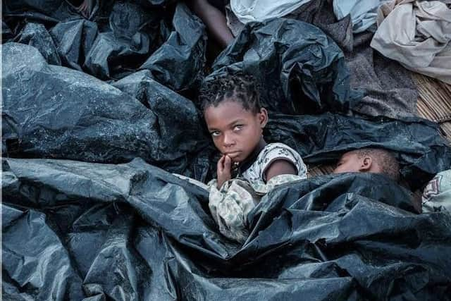
Tens of thousands of people are still trapped by flood waters in Malawi, Mozambique and Zimbabwe and the first cholera death has been reported, but technology from Edinburgh is proving vital.
High tech satellite imaging is being provided free of charge by the uni and its spin out technology firms to map the flood waters in detail.
Advertisement
Hide AdAdvertisement
Hide AdThe governments, charities and NGOs are then able to access up to the minute information and direct the relief efforts.
Deputy Surveyor General of Malawi Alice Gwedeza, a former Edinburgh University student, said: “If we hadn’t had these maps, I’m pretty sure some people may have died as the assessment and support team wouldn’t know the extent of floods.

Satellite images are the best way of monitoring flooding when access from the ground is impossible and monitoring from the air is too expensive.
Casey Ryan, senior lecturer in ecosystem services and global change at Edinburgh University has been working in the area for 15 years.
Advertisement
Hide AdAdvertisement
Hide Ad“It was pretty clear right away that the flooding would be catastrophic,” he said.
“The lives of the people who live around the Pungue and Buzi flood plains in Zimbabwe and Mozambique are precarious at the best of times.
“Other work I’ve done has taught me how vulnerable many households are to any kind of shock.
“In particular, shocks that hit everyone in an area are much harder to cope with as you can’t turn to others for support so easily.”
Advertisement
Hide AdAdvertisement
Hide AdCasey, his PhD student Dr Samuel Bowers, and Iain Woodhouse, who’s Professor of Applied Earth Observation as well as chief executive of satellite imaging company Carbomap, have been working to support the governments in the area.
Iain got in touch with Alice Gwedeza as soon as the cyclone hit.
Alice had studied for her MSc with Iain at Edinburgh University in 2011.
“It was clear that, while there was flood mapping being undertaken, it wasn’t necessarily making its way along the right channels to the right people,” he explained.
Advertisement
Hide AdAdvertisement
Hide Ad“I offered to help and enlisted the team at Carbomap to provide satellite imaging of the affected area. I could then pass this directly to Alice.
“In any natural disaster, time is of the essence.
Gwedeza added that her degree from Edinburgh University has helped her enormously in coping with Malawi’s national disaster.
“I’ve brought a lot of knowledge from Edinburgh University to my role, such as the creation of interactive maps and consolidation of location based information that would support others within a short time as has been the case where I have been instrumental on provision of basic information on all the times we have had floods and drought,” she said.
Meanwhile, Samuel and Casey have been reaching out to the government in Mozambique.
Advertisement
Hide AdAdvertisement
Hide AdThe issue here was the limited internet connection to collect the data to map the flooding.
“We were able to produce these maps quickly as we had the necessary data processing chains already in place,” Sam explained.
“I have been working with the Mozambican government over the past two years on a project aiming to monitor deforestation in Mozambique using remote sensing.
“These data are also very well suited to mapping floodwaters.
Advertisement
Hide AdAdvertisement
Hide Ad“This meant we were in a unique position of being able to rapidly generate flood maps and distribute them to key users in Mozambique.
“Without these, it would be very difficult to get a clear overview of the extent of the flooding and how it is changing over time.”
The maps are being freely distributed; the website where they’re hosted has had hundreds of hits.
The maps have also been distributed amongst government agencies in Maputo, used as part of coordinating rescue efforts by MapAction to map floods in and around Gorongosa National
Advertisement
Hide AdAdvertisement
Hide AdPark by park authorities, and by various NGOs operating in Central Mozambique.
The Department for International Development (DFID) Malawi Head of Office, David Beer said the UK was now the biggest donor to the Cyclone Idai response, providing £22 million of UK aid to deliver life-saving relief to the victims.
“We very much welcome the University of Edinburgh’s work in response to the Malawian floods,” David said.
“Technology such as satellite and drone mapping is an increasingly important factor in assessing the impact of crises, and ensuring that aid swiftly reaches those who most need it.
Advertisement
Hide AdAdvertisement
Hide Ad“The friendship between Scots and Malawians dates back over 150 years, so in their time of need, DFID has committed £3.4 million to support victims of the floods in Malawi over the next three months.”
The UK has flown 211 tonnes of aid to Mozambique including 100 family tents and 9,846 shelter kits to provide temporary accommodation to 49,230 people, 500 water filters, 1000 solar lanterns and 3520 blankets are currently being distributed.
The £3.4m emergency package of support for Malawi focuses on shelter, WASH, food assistance and health through the WFP, UNICEF and Red Cross.