Scotland's weather: Storm Hector to bring 70mph winds and heavy rain
and live on Freeview channel 276
Winds will start to pick up this afternoon blowing away the balmy spell of warm and sunny weather we have enjoyed for weeks.
But it is Thursday morning when the greatest impact of the weather will be felt, arriving at its peak just around rush-hour.
Advertisement
Hide AdAdvertisement
Hide Ad“This will come as quite a shock to the system,” said Bonnie Diamond, a forecaster at the Met Office.
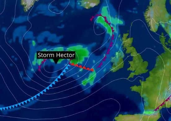
“The change will be felt quite markedly in Scotland, which has enjoyed some of the sunniest and warmest conditions since June began.
“High pressure is slipping away, leading to a return of the low pressure systems coming in from the Atlantic.
“Winds will start to pick up on the west coast on Wednesday afternoon and evening, with heavy rain associated with it.

Advertisement
Hide AdAdvertisement
Hide Ad“However, it will be the early hours of Thursday before they really get going, when gusts of 50 to 60mph can be expected on the western side of the country.
“Winds will readily move east to affect the rest of Scotland.
“In Argyll, near Oban, winds could become even stronger with gusts of up to 70mph.”
Such is the concern for disruption that the Met Office has posted yellow warnings of severe weather for all of Scotland on Thursday.
Advertisement
Hide AdAdvertisement
Hide AdIt states that road, rail, air and ferry services could be badly affected and that some damage to buildings may occur.
There is a slight chance of power cuts in some areas and a “danger to life” could be presented by large waves and beach material being blown onto sea fronts, coastal roads and homes
The Met Office added:”There is a small chance of injuries and danger to life from flying debris.”
Areas affected include Central, Tayside, Fife, Grampian, Highlands and Islands, Orkney and Shetland, south West Scotland, Lothian and Borders and Strathclyde.
Advertisement
Hide AdAdvertisement
Hide AdWith Oban lying in the eye of the storm, it is expected that west coast ferry services could be severely affected.
Gardeners are among the most likely to welcome the impending rainfall. Hardly any rain has fallen in June, save for localised downpours last Saturday during an electrical storm.
Stornoway in Lewis has gone 22 consecutive days without rain.
Meteoroligical equipment can measure as little as one tenth of a millimeter of rain but not even that amount has fallen in Stornoway for 22 days in a row.
Advertisement
Hide AdAdvertisement
Hide AdScottish Water confirmed that stocks are lower in some areas due to the recent dry spell.
A spokesman said:“While it has been drier in some areas than others, we are able to manage our resources accordingly.”
Three-day forecast:
Today: Fine start for many, particularly in east. Winds picking up later. Max 18C (64F) Min 12C (54F)
Thursday: Very strong winds through early morning and rush hour. Breezy all day. Max 20C (68F) Min 10C (50F)
Friday: Winds easing. Return to cloudy conditions, with risk of showers. Max 18C (64F) Min 10C (50F)