Edinburgh Marathon 2019: Full list of road closures and disruption


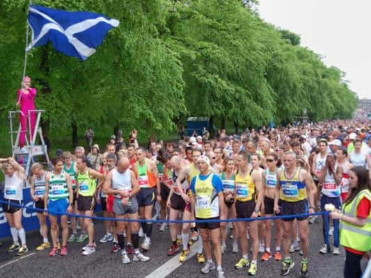
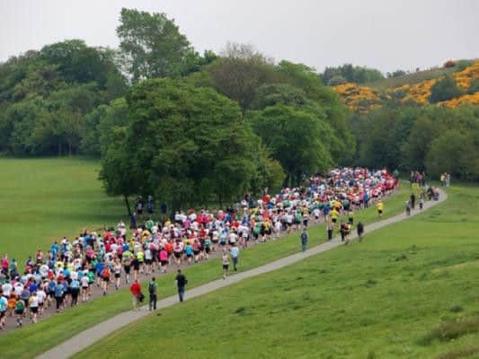
The Edinburgh Marathon Festival - which includes not only the marathon, but also a Team Relay, half marathon, 10K, 5K, Junior 5K, Junior 2K, Junior 1.5K and Kids' Kilometre races - will take place from 25 to 26 May, with multiple road closures in place over the weekend.
The areas affected by road closures have been divided into eight zones.
ZONE 1
Roads closed from 19:30 on 24 May to 16:00 on 25 May
Fully closed: Queen’s Drive
Roads closed from 06:00 to 10:30, 25 May
Fully closed: Old Church Lane
Advertisement
Hide AdAdvertisement
Hide AdPartially closed: Duddingston Road West Northbound from Forkenford to The Causeway (except for number 42 service bus)
Innocent Cycleway Rescind the cycleway status to prevent cyclists intermingling with event runners.
Roads closed from 06:00 to 16:00, 25 May
Fully closed: Abbey Strand
Partially closed: Holyrood Park Road From East Parkside to Queens Drive
Roads closed from 18:00 May 25 to 13:00 26 May
Fully closed: Potterrow, Chapel Street, Buccleuch Street, Charles Street, Hope Park Crescent, West Nicolson Street, George Square (excluding resident and chaplaincy access to the west of the Square), George Square Lane, Crichton Street, Marshall Street
Advertisement
Hide AdAdvertisement
Hide AdPartially closed: Nicolson Square - The West and North legs in their entirety, Partially closed:Brighton Street at junction with Potterrow, Buccleuch Terrace, Gifford Park, Boroughloch at junction with Hope Park Crescent, Meadow Lane, West Crosscauseway at junction with Buccleuch Street, Windmill Street at junction with Chapel Street
Roads closed from 07:00 to 11:00, May 26
Fully closed: Bristo Place, Teviot Place, Forrest Road, George IV Bridge, Victoria Street, Lawnmarket, Bank Street, North Bank Street, Mound Place, The Mound
Partially closed: Forrest Hill at junction with Forrest Road, Bristo Port at junction with George IV Bridge, Lauriston Place from the entrance to George Heriots School to Forrest Road, Candlemaker Row and Chambers Street at junction with George IV Bridge, West Bow from junction with Grassmarket to Victoria Street, St Giles Street at its junction with North Bank Street.
Roads closed from 07:00 to 11:15, May 26
Fully closed: Cockburn Street, Waverley Bridge, Market Street, Jeffrey Street, Canongate
Advertisement
Hide AdAdvertisement
Hide AdPartially closed: Hanover Street at its junction with Princes Stree, Holyrood Gait at its junction with Queen’s Drive. Old Tolbooth, Wynd Brown’s Close, Galloways Entry and Cranston Street at junction with Royal Mile. New Street Between East Market Street and Canongate
Roads closed from 07:00 to 11:30, May 26
Partially closed: Queen’s Drive: From Horse Wynd to Holyrood Gait (normal Sunday closure of Queen’s Drive will also be in place). East Market Street at Market Street/Jeffrey Street junction
Duke’s Walk at its junction with Meadowbank Terrace (normal Sunday closure of Dukes’ Walk will also be in place)
Royal Park Terrace At its junction with Meadowbank Terrace
Roads closed from 18:00 25 May to 10:30 to 26 May
Fully closed: Buccleuch Place (access for event buses only)
Partially closed: Buccleuch Place at its junction with Buccleuch St. (access/ egress for event buses and residents only)
Horse Wynd
Advertisement
Hide AdAdvertisement
Hide AdFully closed: 06:00 to 16:00 on 25 May, 07:00 to 11:30 on 16 May, 19:30 on 24 May to 18:00hrs on 25 May
ZONE 2
Roads closed from 07:00 to 11:45, 26 May
Fully closed: Meadowbank Terrace, Restalrig Avenue, Craigentinny Avenue, Fillyside Road
Partially closed: Marionville Avenue at its junction with Restalrig Road South. Loganlea Drive, Loganlea Avenue and Britwell Crescent at its junction with Restalrig Avenue
Stapeley Avenue, Fillyside Terrace and Fillyside Avenue at its junction with Craigentinny Avenue
Nantwich Drive at its junction with Fillyside Road
Roads closed from 07:00 to 12:00, 26 May
Fully closed: Seafield Recycling Centre Road
Roads closed from 08:00 to 09:35, 26 May
Advertisement
Hide AdAdvertisement
Hide AdPartially closed: Craigentinny Road at its junction with Craigentinny Avenue in both directions. Seafield Road from the access to the council recycling centre to Seafield Road East. Seafield Road East from Seafield Road to the entrance to Screwfix
Roads closed from 10:10 to 11:30, 26 May
Partially closed: Craigentinny Road at its junction with Craigentinny Avenue in both directions. Seafield Road from the access to the council recycling centre to Seafield Road East. Seafield Road East from Seafield Road to the entrance to Screwfix
ZONE 3
Roads closed from 05:00 to 13:30, 26 May
Harbour Road at its junction with New Street
Roads closed from 07:00 to 12:00, 26 May
Fully closed: King’s Place
Partially closed: Eastfield Place at junction with Eastfield, Booker Wholesale access Rd at junction with Eastfield Edinburgh Rd. Access road into housing estate at junction with A199, King’s Road at its junction with King’s Place
Roads closed from 05:00 to 13:30, 27 May
Fully closed: Unnamed entrance west of New Street
ZONE 4
Roads closed from 05:00 to 13:30, 26 May
Fully closed: Downie Place, Ladywell, Eskdale Mews and Mountjoy Terrace/Mountjoy Ct
Advertisement
Hide AdAdvertisement
Hide AdPartially closed: Beach Lane at its junction with Promenade, Links Avenue at its junction with Links View, Links Street at its junction with New Street, Eskside West at its junction with New Street
Eskside East, James Street and Goose Green Road at junction with Goose Green Crescent
Goose Green Avenue and Goose Green Place at junction with Goose Green Crescent
New Street between Edinburgh Rd and Harbour Rd and between Links View and Eskside West
High Street between Linkfield Rd and Newbigging
Roads closed from 05:00 to 13:30, 26 May
Old Course Gate at its junction with Balcarres Rd
Roads closed from 05:00 to 18:30, 26 May
Advertisement
Hide AdAdvertisement
Hide AdFully closed: Beulah, Linkfield Court and Windsor Gardens, Craighall Terrace
Rothesay Place (access and egress to Residents and permit holders only)
Macbeth Moir Road, King Street, Wanless Court, Battlefield Drive/Almond Park: from the junction with Pinkie Road (access and egress to residents, permit holders and public service buses only)
Partially closed: Ashgrove - At its junction with Linkfield Road and at its junction with Pinkie Road
Advertisement
Hide AdAdvertisement
Hide AdPinkie Road Service Road, Pinkie Terrace, Edenhall Road, Park Lane: At its junction with Pinkie Road (access and egress to Residents and permit holders only)
Grove Street and Lower Pinkie Road - at its junction with Pinkie Road (access and egress to Residents and permit holders only)
ZONE 5
Roads closed from 05:00 to 18:30, 26 May
Fully closed: Ravensheugh Road (B1348), Hope Place, Mayville Bank and Ravensheugh Crescent
Partially closed: Unnamed stretch (B1348) Prestongange from Ravensheugh Road to Prestonpans High St
Advertisement
Hide AdAdvertisement
Hide AdUnnamed entrance to Drum-Mohr at its junction with Ravensheugh Rd
Managers Brae at its entrance Ravensheugh Road
Levenhall Links Access Road and Prestongrange Mining Museum access Road: At its junction with B1348
ZONE 6
Roads closed from 05:00 to 18:00, 26 May
Fully closed: Prestonpans High Street (B1348), Inchview North, Cookies Wynd, Ormiston Place, West Seaside, East Seaside, Salt Preston Place, Sir Walter Scott Pend and Unnamed Road to boat enclosure
Partially closed: Edinburgh Rd, Cockenzie (B1348) - From its junction with the B1348 at Cockenzie Power Station to East Lorimer Place
Advertisement
Hide AdAdvertisement
Hide AdWhin Park Industrial Estate at its junction with Edinburgh Road. West Lorimer Place and West Harbour Road at its junction with North Lorimer Place. West Harbour Road at its junction with Cockenzie High St
Prestongrange Road, The Pottery and Redburn Road North - At its junction with Prestonpans High Street
New Street, Prestonpans, Ayres Wynd, Harlaw Hill, Pypers Wynd, Robertson Avenue and Fowlers Court - at its junction with Prestonpans High Street
Nethershot Road (Appin Drive) - at its junction with Prestonpans High Street
Advertisement
Hide AdAdvertisement
Hide AdEast Lorimer Place Lane (to the rear) - at its junction with North Lorimer Place
East Lorimer Place - at its junction with Edinburgh Road
Roads closed from 05:00 to 17:00, 26 May
Fully closed: Cockenzie High Street, Elcho Place, Wemyss Place, Viewforth Seton Place, Barga Court, Marshall Street, South Doors, School Lane, New Street, Hares Close, Gardiner’s Close, Kay Gardens, Manse Lane, Unnamed entrance west of Cope Ln., Cope Lane, Barracks Street
Gosford Road Eastbound in its entirety
Partially closed: Edinburgh Rd, Cockenzie (B1348) - From East Lorimer Place to Gosford Road, eastbound only
Links Road (B1348) - Eastbound, between Seton Place and Seton Sands Holiday Park entrance
Advertisement
Hide AdAdvertisement
Hide AdPark Road and Fishers Road- at its junction with Gosford Rd (EXIT WESTBOUND ONLY ALLOWED— LEAVING PORT SETON VIA EAST LORIMER PLACE)
The Promenade - at its junction with Links Road
Links Court, Castle Terrace and Long Craigs: At its junction with Links Rd (EXIT WESTBOUND ONLY ALLOWED— LEAVING PORT SETON VIA EAST LORIMER PLACE)
Inchview and Lidl Prestonpans Access Road - at junction with High Street
Unnamed road leading to Hawthorn Terrace - at junction with Edinburgh Road
ZONE 7
Roads closed from 05:00 to 17:00, 26 May
Advertisement
Hide AdAdvertisement
Hide AdPartially closed: B1348 (Coast Road) - from east of Seton Sands Holiday Park entrance to Lyars Road (A198), Dean Road between B1348 (Coast Road) and Kings Avenue, Lyars Road - Just north of its junction with Gosford Road
ZONE 8
Roads closed from 05:00 to 17:00, 26 May
A198 - From the junction with B1348 (Coast Rd) to the access to Greencraig