Scotland's weather: More snow and ice for north


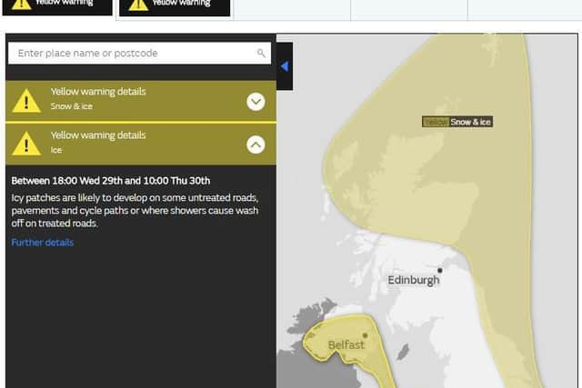
A yellow - "be aware" - severe weather alert will be in force from 6pm until 11am tomorrow.
Up to another 5cm of snow are expected on ground above 100m.
Advertisement
Hide AdAdvertisement
Hide AdIce is expected on untreated roads and paths, including where showers have washed off grit.
Temperatures are expected to fall overnight to -3C in Glasgow, -2C in Aviemore, 0C in Edinburgh.
Road closures include the A939 between Cock Bridge and Tomintoul in the north east, which has been shut since Monday night.
Advertisement
Hide AdAdvertisement
Hide AdA Met Office spokesperson said: "Icy patches are likely to develop on some untreated roads, pavements and cycle paths, or where showers cause wash off on treated roads.
"Wintry showers will bring an additional hazard and may lead to 2 to 5cm of snow accumulating on ground above 100m, with smaller amounts at lower levels, primarily over northern Scotland and north-east England.
"Some roads and railways are likely to be affected, with longer journey times by road, bus and train.
"The extent of ice will vary across the area, with inland areas most prone whilst coastal areas are less likely to be affected.
Advertisement
Hide AdAdvertisement
Hide AdScotland will remain cold tomorrow and Friday, with temperatures increasing slightly over the weekend before a possible return to colder weather next week.
The maximum temperature in Edinburgh is forecast to be 3C tomorrow and Friday, 7C on Saturday and 8C on Sunday.