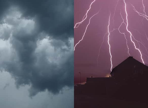
Thunderstorms UK: The areas set to be hit by heavy rain and extreme heat after weather warnings


After Scottish areas such Dumfries and Galloway recorded their hottest temperatures of the year so far this week in a sizzling 29C day for the region on Thursday (July 22), many will be pleased to hear that temperatures are finally set to cool across the UK as we head into the weekend.
But while we can usually expect to see the wettest of the country’s weather above the border, weather forecasts for the weekend ahead appear to see Scotland spared from the downpours, thunderstorms and potential flooding to hit other parts of the UK.
Advertisement
Hide AdAdvertisement
Hide AdIt is likely that Scotland won’t be hit by rain or storms until next week, when cooler temperatures, more cloud coverage and rain is set to sweep over the nation, with heavier downpours expected in and around the Central Belt from Tuesday onwards.
Here’s the what the Met Office’s latest weather forecast and warnings mean for different areas of the UK.
Is extreme heat still expected for the UK?
As coronavirus restrictions eased across areas of the UK on Monday July 19, the Met Office also imposed its first ever extreme heat warning for the UK as temperatures began to spike across the country.
In Scotland, the move into Level 0 Covid restrictions collided with rising temperatures which soared throughout the rest of the week, as areas on the west coast recorded almost 30C highs in temperature as the demand for water to cool down climbed across the country on Thursday.
Advertisement
Hide AdAdvertisement
Hide AdWhile the Met Office’s amber alert for extreme heat has now been lifted for most parts of the UK, the warning is still in force for Northern Ireland until midnight on Friday.
Unlike cities like Glasgow, Edinburgh and London, Belfast and Derry in Northern Ireland are still expected to see warmer, more humid temperatures of around 25-26C today before gradually easing over the weekend.
Where are yellow warnings for rain in force?
Among the other UK weather warnings announced by the Met Office for this weekend are yellow warnings for rain, which are expected to affect mostly southern and central areas of England on Friday, Saturday and Sunday.
David Oliver, Met Office deputy chief operational meteorologist, said: “This yellow rain warning comes as temperatures are set to dip for many areas over the weekend.
Advertisement
Hide AdAdvertisement
Hide Ad"A spell of rain, heavy in places perhaps with some thunder, moves in from the southwest late on Friday and into Saturday.
Mr Oliver added that while sunny intervals and warmth were to be expected for Northern areas this weekend, up to 100millimetres of rainfall could be seen in the south of England – seeing a rise in potential flash flooding risks, hail and stormy conditions in this region.
Which areas could see thunderstorms?
Cities across England like Manchester have already started to experience thunderstorms as a result of what the Met Office has called ‘unsettled conditions’ developing in the UK towards the end of this week.
Some of the areas included in yellow rain warnings across Saturday and Sunday like London, Reading and Southampton are at risk of seeing heavier, thundery showers and downpours according to latest weather forecasts.
Advertisement
Hide AdAdvertisement
Hide AdThis follows extremely hot temperatures of around 32C recorded at London Heathrow Airport on Thursday, with the yellow warnings for rain and thunderstorms stretching across the entire weekend but expected to hit particularly hard on Sunday afternoon.
Travel disruption and difficulty has been declared to be a potential issue arising from greater build-up of surface water in these areas, as drivers have been warned to take care when driving in southern areas prone to flash flooding that could be impacted by heavy showers.
What about next week’s weather?
Scotland looks to remain dry in comparison to England and Wales this weekend, rainfall is expected to develop and become more persistent in more northernly areas of the country from early next week.
In particular, spells of heavy rain look to hit northern Scotland from Monday onwards – with locations like Loch Rannoch potentially seeing a thundery afternoon on Monday and frequent downpours thereafter along with western areas like Glasgow, Paisley and Stirling.
Advertisement
Hide AdAdvertisement
Hide AdThe Met Office predicts that the rest of the week should see slightly lower temperatures than this week, but with a mix of sunny spells and heavy showers likely across most of the UK.
A message from the Editor:
Thank you for reading this article. We're more reliant on your support than ever as the shift in consumer habits brought about by coronavirus impacts our advertisers.
If you haven't already, please consider supporting our trusted, fact-checked journalism by taking out a digital subscription.
Comment Guidelines
National World encourages reader discussion on our stories. User feedback, insights and back-and-forth exchanges add a rich layer of context to reporting. Please review our Community Guidelines before commenting.
