Scotland weather: Met Office warn of 'heavy snow showers' as alert upgraded to amber
and live on Freeview channel 276
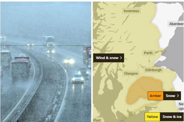
Forecasters predict heavy snow showers in parts of the Borders, Dumfries and Galloway and the edge of the Lothians. The alert has been upgraded from yellow to amber - the second highest level - meaning travel delays on roads are likely, stranding some vehicles and passengers.

The worst of the snowfall is expected between 2pm and 9pm on Tuesday.

Advertisement
Hide AdAdvertisement
Hide AdThe Met Office said: "Snow showers will become frequent and heavy at times through Tuesday afternoon and evening giving accumulations of 10 cm of snow within a few hours, particularly above 150 metres.
"Strong winds, gusting over 50 mph at times, will lead to blizzard conditions and considerable drifting of lying snow over high ground."
The east coast is already experiencing significant transport disruption after the £1.35bn Queensferry Crossing was shut last night and remains closed today.Motorists were warned to brace for major disruption, with a lengthy diversion required for those travelling by car between Fife and Edinburgh.
Drivers travelling southbound have been advised to divert via the A985 to the Kincardine Bridge and the M9, and the reverse for northbound traffic.