Edinburgh weather: Met Office forecast this weekend in wake of Hurricane Ian - is it hitting UK shores

and live on Freeview channel 276
Cooler weather with a spell of strong winds and heavy rain is forecast for Edinburgh when then the dying embers of former hurricane Ian makes its way across the United Kingdom at the end of the week.
The Met Office said the storm will push tropical air across the UK on Friday, causing heavy rain in several parts of the UK.
Advertisement
Hide AdAdvertisement
Hide AdHowever, nothing out of the ordinary for the time of year, such as a significantly wetter and windier stretch than the UK has experienced so far this October.
Deputy Chief Meteorologist at the Met Office, Chris Almond, said; “This will bring a much wetter and windier spell than we’ve seen so far this autumn, but nothing that is unusual for the time of year.
“The fast-moving system will bring strong gale force winds, locally in excess of 60mph, and heavy rain into the northwest before pushing quickly southeast through the day.
“We could see some minor impacts, such as surface water flooding or minor wind damage, as well as some short-lived impacts on ferry crossings, especially in exposed areas of western Scotland and eastern areas of Northern Ireland.
Advertisement
Hide AdAdvertisement
Hide Ad“Later in the day, parts of southeast England could experience winds of around 55mph, which may impact the English Channel too.”
Meanwhile, rain showers will continue in the south on Saturday, sunny spells, and heavy, blustery showers elsewhere.
Sunday is looking a little more settled before further unsettled conditions arrive in the northwest from Monday onwards.


What is Hurricane Ian?
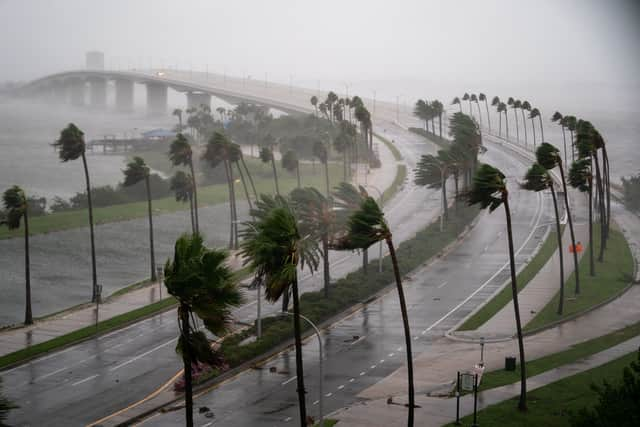
Hurricane Ian made landfall on Wednesday afternoon in Florida, slamming into the coast with winds of up to 150mph and it is said to be one of the most powerful storms in US history.
Advertisement
Hide AdAdvertisement
Hide AdA hospital roof was blown off, cars were submerged, and trees were ripped out of the ground in dramatic scenes.
The category four hurricane was downgraded to a tropical storm later on, forcing thousands to evacuate.
Ian is presently making its way north via Florida. Jacksonville International Airport in north-eastern Florida has cancelled all flights for Thursday.
The hurricane is expected to reach the Atlantic on Thursday morning.
Advertisement
Hide AdAdvertisement
Hide AdOn Friday, it is predicted to make landfall in Georgia and South Carolina. Virginia has declared a state of emergency, joining Georgia, North Carolina, South Carolina, and Florida.
Hurricane Ian made landfall on Cuba’s western coast on Tuesday, September 27. After the island was thrown into total darkness, power has now been restored in certain sections.
What is Edinburgh’s weather forecast this weekend?
Thursday, September 29, 2022
Thursday will begin gloomy and rainy in the east, but the rest of the day will be bright with sunny breaks emerging.
In the afternoon, scattered showers will develop under increasing cloud cover.
Advertisement
Hide AdAdvertisement
Hide AdOccasionally strong northeasterly winds that quickly subside. Maximum temperature of 17°C.
Tonight will be primarily dry with clear spells. Early-morning cloudiness intensifies with intermittent rain that becomes persistent in the west and spreads eastward.
Increasing southerly winds with a minimum temperature of 7°C.
Friday, September 30, 2022
Friday will have a wet, windy morning with continuous and, especially across western hills, heavy rain, strong southerly winds, and gales along the coast.
Advertisement
Hide AdAdvertisement
Hide AdIn the afternoon, circumstances became sunnier, rainy, and less windy to the east with a maximum temperature of 16°C.
Saturday, October 1, 2022 - Sunday, October 2, 2022
Saturday will see sunny intervals and occasional heavy, possibly thundery, precipitation. Following a dry Sunday morning, clouds and rain showers will travel northeast on Monday.
Sunday will be mostly dry and sunny, but after a dry Monday morning, clouds and rain showers will spread northeast.
Comment Guidelines
National World encourages reader discussion on our stories. User feedback, insights and back-and-forth exchanges add a rich layer of context to reporting. Please review our Community Guidelines before commenting.