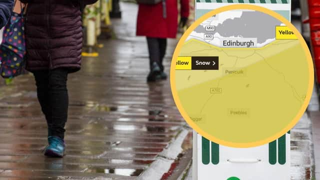
Edinburgh weather warning: Here's what forecasters predict the Capital's weather will be like on Wednesday as yellow snow warning remains in place


The Forecasters have predicted that rain will increasingly turn to snow during Wednesday and overnight into Thursday in some areas of Southern Scotland which may cause disruption.
Areas affected by the snow in the south west of Scotland include Dumfries and Galloway, East Lothian, Midlothian Council, Scottish Borders, West Lothian and Edinburgh, however, the snow warning does not cover the centre.
Advertisement
Hide AdAdvertisement
Hide AdA temperature of 3 °C is expected throughout the Capital tomorrow with a forecast of heavy rain in the early hours and rain expected throughout the day.
Areas such as Balerno, Bonnyrigg and Penicuik have been covered by the snow warning.
Cloudy with outbreaks of rain across Dumfries and Galloway and Borders will extend north into Edinburgh and Lothians this evening.
The rain will turn to snow on the hills and affect some higher ground overnight, according to the Met Office, with a minimum temperature of -1 °C.
Advertisement
Hide AdAdvertisement
Hide AdThe rainy conditions are expected to begin at midnight tonight with snowy conditions in some areas beginning at 12pm tomorrow and lasting until midday on Thursday.
Possible travel delays on roads stranding some vehicles and passengers are expected from the snow as well as possible delays or cancellations to rail and air travel.
Some rural communities could become cut off while power cuts may occur and other services, such as mobile phone coverage, may be affected.
A Met Office spokesperson said: “Persistent rain over southern Scotland and the far north of England will increasingly fall as snow above around 100 m during Wednesday afternoon and overnight into Thursday.
Advertisement
Hide AdAdvertisement
Hide Ad"A few cm of wet snow may accumulate down to around 100 m but above 200 m 10-15 cm may settle with perhaps 20-30 cm above 400 m. Rain is more likely on lowest ground near the east coast and may bring some localised surface water flooding.”
Areas in the Strathclyde area affected by the snow warning include East Ayrshire, East Renfrewshire, North Lanarkshire, South Ayrshire, South Lanarkshire.