Scotland’s weather: Drivers battling blizzards as further snow and ice warning issued

and live on Freeview channel 276
The latest Met Office yellow severe warning for much of Scotland away from coasts will take effect when the current one ends at 8pm, and be in force until 9.30am on Friday.
The agency said there was likely to be further rain, sleet and hail, with snow mainly above around 200-300m.
Advertisement
Hide AdAdvertisement
Hide AdIts spokesperson said: “These will be heavy in places, perhaps bringing 2-5cm of snow to some of the higher routes across the Pennines and Scotland.
"Beyond midnight, showers will become less widespread and will fall increasingly as rain or sleet away from some higher routes and parts of northern Scotland.
"However as temperatures fall, icy stretches are possible more widely, especially on untreated surfaces.”
The alert was issued as gritters battled to keep major roads clear of snow.
Advertisement
Hide AdAdvertisement
Hide AdThose affected included the M90 between Edinburgh and Perth and the A92 in Fife.
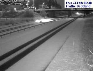

Bear Scotland, which maintains most of the country’s motorways and trunk roads, said dozens of gritters had been out continuously overnight through "challenging conditions".
School buses were unable to operate in parts of South Lanarkshire, with some schools opening late.
ScotRail said speed restrictions because of the severe weather would disrupt services on routes including between Edinburgh/Glasgow and Dunblane, Falkirk Grahamston, Aberdeen and Inverness.
Advertisement
Hide AdAdvertisement
Hide AdAvanti West Coast trains were delayed between Glasgow and Carlisle.

The Met Office warning in force until 8pm said 3-7cm of snow is likely to build up in some areas, even at low levels, while on higher ground some places could see 10-20cm accumulate.
It stated: "The showers will be accompanied by strong, blustery winds, with gusts of 45-55mph possible, and a chance of 65mph on coasts.
"Blizzard conditions are likely over higher ground.
"There is a small chance that some of the showers could be accompanied by frequent lightning, which could impact power supplies, including some places outside of the warning area.
Advertisement
Hide AdAdvertisement
Hide Ad"Snow showers are increasingly likely to turn back to rain and sleet at low levels later Thursday morning and early afternoon, although remaining as snow above 200-300m."
The Scottish Environment Protection Agency issued four flood warnings for rivers in Perth and Kinross, and the Clyde coast between Ayr and Troon.
The Met Office also warned of more unsettled weather to come.
Chief meteorologist Frank Saunders said: “A cold front, followed by cold arctic Canadian air, has now pushed south across the country and has brought a spell of windy, showery and cold weather.
Advertisement
Hide AdAdvertisement
Hide Ad“A ridge of high pressure builds on Friday, resulting in a fine, bright day for most.
"However, the winds pick up again as we head into the weekend, with weather fronts bringing rain to the north and west and milder air spreads back in here.”
The agency added that on Sunday an area of low pressure passing to the north west of the UK, moving towards Iceland, is expected to bring further strong winds and rain to the northwest of the country.
A message from the Editor:
Thank you for reading this article.
We're more reliant on your support than ever as the shift in consumer habits brought about by coronavirus impacts our advertisers.
If you haven't already, please consider supporting our trusted, fact-checked journalism by taking out a digital subscription.
Comment Guidelines
National World encourages reader discussion on our stories. User feedback, insights and back-and-forth exchanges add a rich layer of context to reporting. Please review our Community Guidelines before commenting.