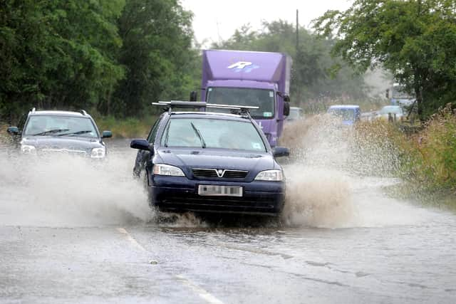
Edinburgh weather: Flood alert issued as rain forecast to batter Edinburgh for the next 12 days

and live on Freeview channel 276
Rain is set to fall in Edinburgh for the next 12 days, according to the BBC weather forecast.
Downpours are forecast to last from March 15 until March 27. Edinburgh has already seen heavy rain over the weekend and Monday, and is currently under a flood alert. Warning locals of potential disruption, the Scottish Environmental Protection Agency said: "Heavy rainfall has affected the area during Monday. There is a risk of flooding from surface water and rivers during Monday afternoon and evening into early Tuesday morning. Possible impacts may include localised flooding of low lying land and roads, flooding of properties and localised disruption to travel.”
Advertisement
Hide AdAdvertisement
Hide AdSleet showers are forecast for today, Tuesday March 14, however the weather is expected to turn dry but sunny towards the late afternoon. Sun will also shine for most of the day on Wednesday, March 15, before light rain and sleet showers are set to hit the Capital during the evening. Heavy rain is forecast to batter Edinburgh throughout the day on Thursday, March 16, with light rain also forecast for Friday through to Sunday. According to the BBC forecast, the Capital will also see rainy weather next week, from March 20 to 27.

While BBC weather has forecast rain for the next 12 days, the Met Office has predicted that Edinburgh will see mostly cloudy and dry weather. However, the weather forecaster has said that heavy rain will fall in the Capital on Thursday, March 16.
Met Office Chief Forecaster, Dan Suri, said: “An area of low pressure moving eastward has brought a mild, and blustery start to the week for much of England and Wales, with showers and some coastal gales. However, an Arctic maritime air mass will reassert itself from the north later today bringing with it another dose of snow and frosty nights for some. As we head through the second half of the week conditions turn milder, wetter and windier from the west. This change to milder conditions will be preceded by some snow over parts of northern England and Scotland later on Wednesday, mainly over higher ground.”