
Met Office extends weather warning as further snow and ice predicted to hit city

Edinburgh continues to brace for snow and ice, with a weather warning have been extended into Friday.
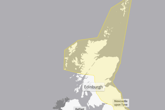
The Met Office has extended the yellow weather warning which covers much of Scotland’s east coast and central belt, including Edinburgh and the Lothians. Wintry showers are expected to bring patchy ice and some fresh snow accumulations - with some roads and railways likely to be affected with longer journey times by road, bus and train services.
Weather warnings have been in place for much of this week, but the Scottish capital is yet to see snow fall. The weather warning has now been extended until 12pm on Friday, January 9.
The Met Office warned of the likelihood of some injuries from slips and falls as ice resurfaces throughout the evening and night.
A spokesman said: “Ice is expected to form widely again as surfaces refreeze through the evening and overnight.
“Scattered wintry showers will move inland across parts of northern England and eastern Scotland this evening and overnight into Friday. Showers may lead to some further modest snow accumulations of a few cms inland and over higher ground.”

Temperatures are expected to remain around 1°-3°, with the coldest spells overnight. Edinburgh could yet see snow however, with flurries forecast overnight on Friday and into Saturday morning.
Edinburgh has largely avoided the impact of the snowy conditions seen in the north-east of Scotland. In Aberdeen and Aberdeenshire, schools have remained closed as pupils prepared to return after the festive period.
Travel was also heavily affected in the early part of the week, with services between Edinburgh, Aberdeen and Inverness commencing and terminating at Dundee. Services have now largely resumed - with some cancellations still occurring in the most northernly areas of the country.