
Everything you need to know about the plans for Edinburgh's new North-South tramline
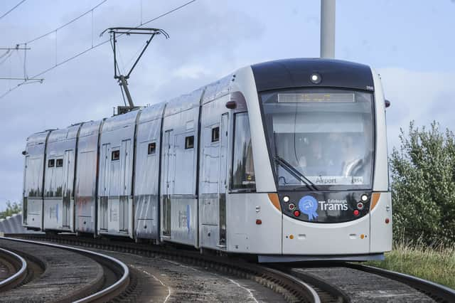
It’s more than a decade since trams returned to the streets of Edinburgh. Since then, the line from the airport to the city centre has been extended to Newhaven. And now there are plans for a new line going from north to south.
There are different views about the idea of expanding the tram network and the details of the proposals.
But here are answers to key questions about what would be a major project for the Capital.

What exactly is being proposed?
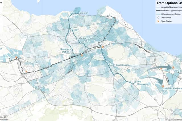
The plan is for a North-South tramline from Granton through the city centre to the Royal Infirmary, the BioQuarter and beyond. The new line would mean more tram connections between major housing and employment zones across the city.
What does "and beyond" mean?
The current proposals would take the tramline as far as the Infirmary and the BioQuarter, but there is scope for new links into Midlothian and East Lothian, either by tram or "rapid transit" buses. Key potential destinations identified to the south-east include Niddrie, Fort Kinnard, Newcraighall Park and Ride, Queen Margaret University, Musselburgh Rail Station and Shawfair. A route eastward from Edinburgh BioQuarter via Niddrie Mains Road has been safeguarded as part of City Plan 2030.
Are there different options for the route?
For most of the way, there is one proposed route which has been plotted fairly precisely.
But on the northern part of the line, the consultation includes two alternatives for the section between Ferry Road and the city centre.
The choice is between using the Roseburn Path pedestrian and cycle route or going via Crewe Road South, Orchard Brae and over Dean Bridge.
Would walkers and cyclists no longer be able to use Roseburn Path?
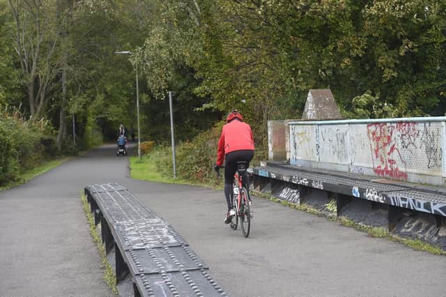
If the Roseburn Path route is chosen for the trams, a pedestrian and cycle active travel route would be retained alongside the new tramline - though the council acknowledges it would not provide the same experience as just now.
The council says for most of the length of the Roseburn Path, the minimum width for walking, wheeling and cycling would be 3 metres, similar to existing the existing width. Where there is a narrow section of path at Roseburn bridge, alternative cycle routes would be provided but cyclists could continue to use the Roseburn Path if they chose.
Fencing would separate the active travel route from the tramline and there would be designated crossing points along the route.
How does it fit with the existing tramline?
Trams on the new North-South service would use the existing tram track going through the city centre. Depending on which route is chosen for the northern stretch of the new tramline, it would join the existing line near Haymarket (if the Roseburn Path routes is chosen) or at Queensferry Street (if the Orchard Brae route is chosen) and leave it again at the east end of Princes Street to go down North Bridge.
Where would the stops be?
There would be 16 new stops built along the new tramline if it goes via the Roseburn Path and 17 if it follows the Orchard Brae route. We take a closer look at each stop here. The new stop proposed for North Bridge is forecast to become the busiest on the entire network and would include a lift directly down to Waverley station.
How well would it be used?
Edinburgh is a fast-growing city. The current population of 523,000 is expected to rise to 564,000 by 2032 and 587,000 by 2042. Forecasts suggest the annual number of passengers using Edinburgh's trams will increase from 12.1 million this year to 34 million by 2032, including 13 million passengers on new North-South route. And by 2042, the forecasts are for that to increase to 38 million, including 14 million on the North-South line.
How much would it cost?
The new line is estimated to cost between £2 billion and £2.9 billion.
If the Roseburn Path option is taken, the estimated cost for that stretch of the line would be between £350m and £480m. If the Orchard Brae route is followed, the estimated cost would be between £650m and £850m.
How would it be paid for?
The council has made clear it cannot afford to pay for the expansion of the tram network and it hopes the Scottish Government will help fund it.
The government appeared to give its backing to expansion of the network when it published its national transport blueprint, the second Strategic Transport Projects Review (STPR2), in December 2022. The document listed Edinburgh and South East Scotland Mass Transit as an investment priority.
But since then, there has been uncertainty over the prospect of Scottish Government funding, In November 2024, Transport Secretary Fiona Hyslop said any new tramline should improve links with communities in neighbouring local authorities and ought to be seen in the context of wider mass transit and not just “tram in isolation”.
And an internal Transport Scotland briefing not, released under FoI legislation, said: "There is no evidence to suggest the Granton to BioQuarter tram proposal is a regional scheme.
"Additionally, such support from the Scottish Government is not affordable in the current fiscal climate, nor in line with the recent recommendations of the tram inquiry."
Does this tramline somehow fit with hopes for reopening the South Sub?
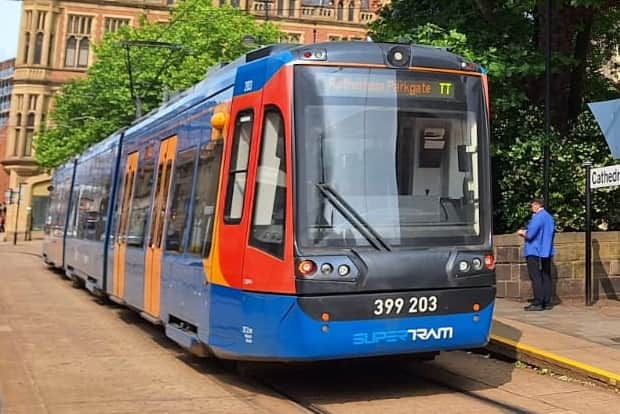
There are proposals which would see the introduction of tram trains in Edinburgh, which can run on both tram tracks and railway lines. This would allow the old South Suburban line, which is currently used only for freight and as a diversion route, to be linked to the tramline and open up a new range of journeys.
The plans were drawn up by civil engineering postgraduates at Heriot-Watt University and are now being promoted by a campaign group Tram Train Edinburgh.
How can I give my views?
A 12-week consultation is currently under way and closes on November 17, 2025. https://consultationhub.edinburgh.gov.uk/sfc/tram-north-south/